
The map above is of Elizabethan England and Wales made by the Father of English Cartography; Christopher Saxton.
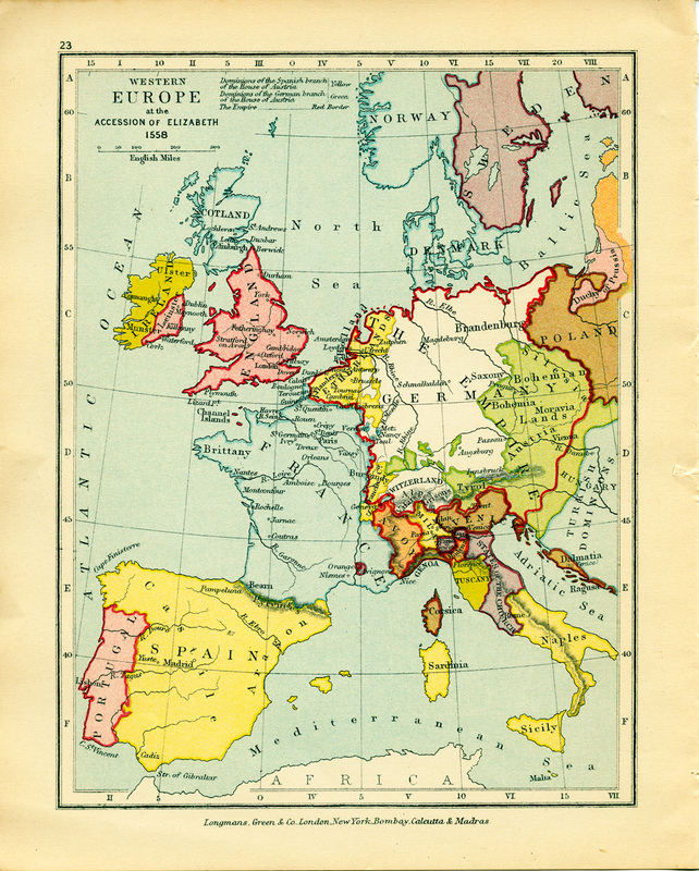
The above image is a more simplistic and clear map depicting the land Elizabeth Tudor came into possession when inheriting the throne and titles of Queen of England, France, and Ireland.
